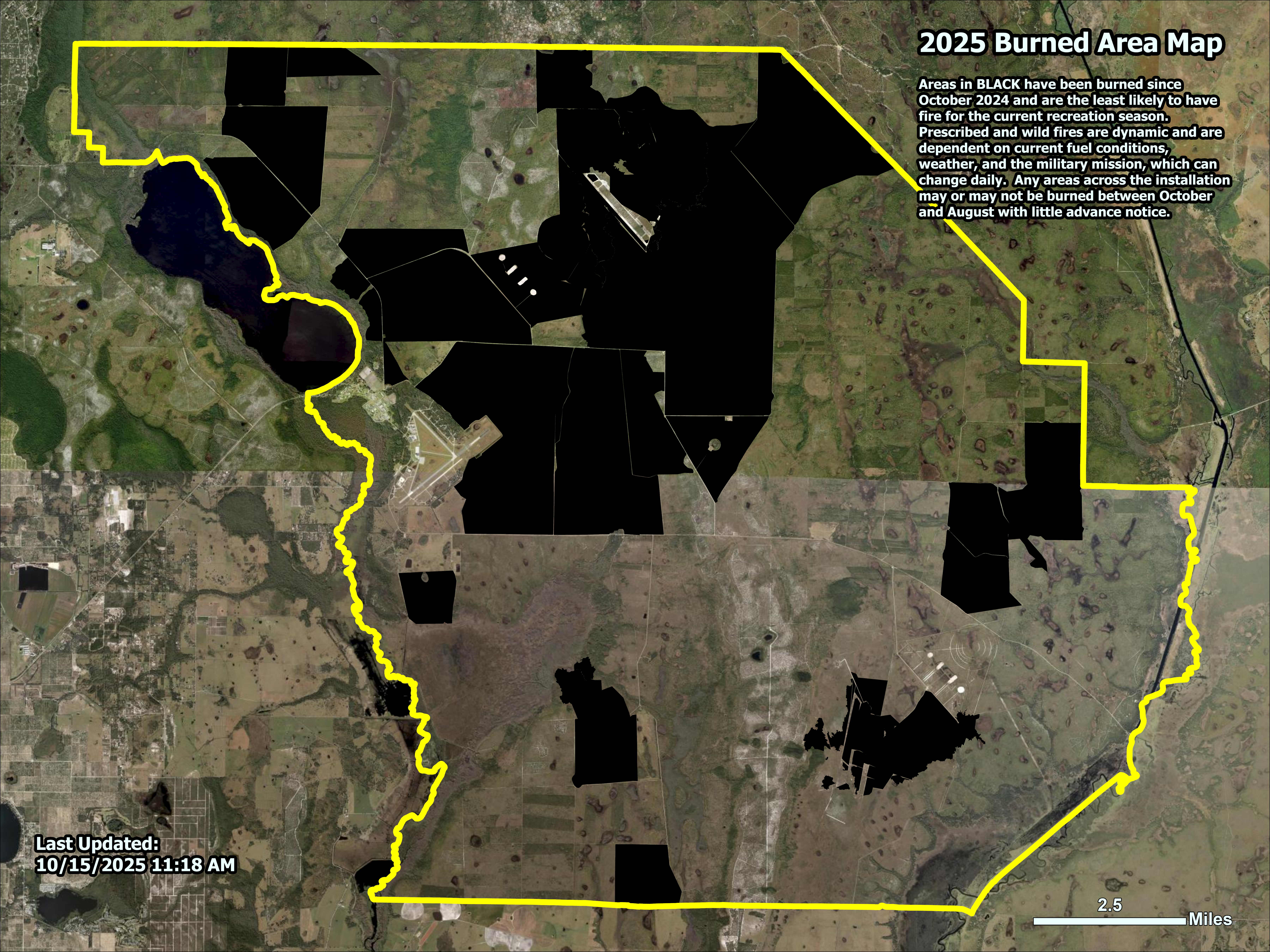
2025 Burned Area Map
UPDATED October 2025: Areas in BLACK have been burned since October 2024 and are the least likely to have fire for the current recreation season. Prescribed and wild fires are dynamic and are dependent on current fuel conditions, weather, and the military mission, which can change daily. Any areas across the installation may or may not be burned between October and August with little advance notice.
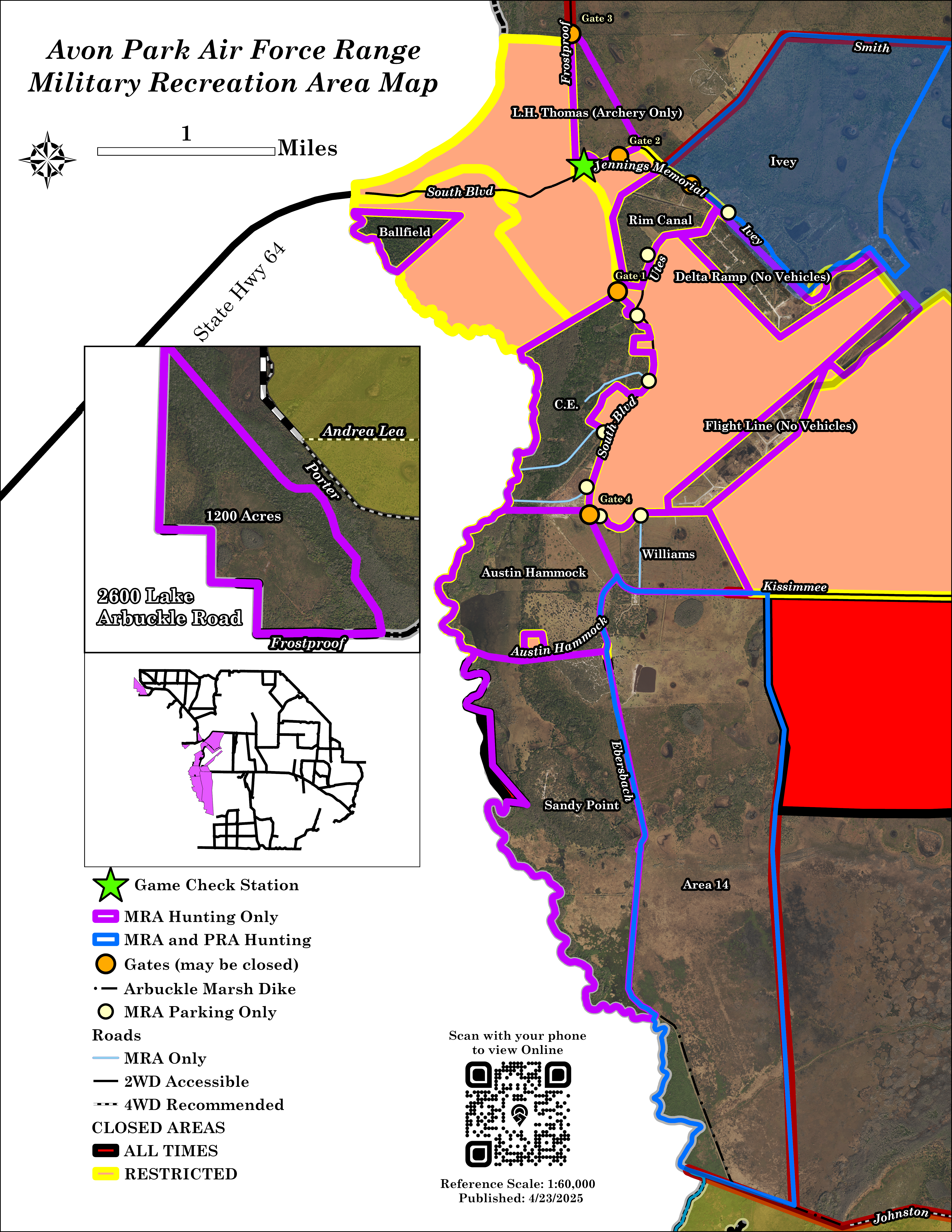
Recreation Map (2026)
.jpg)
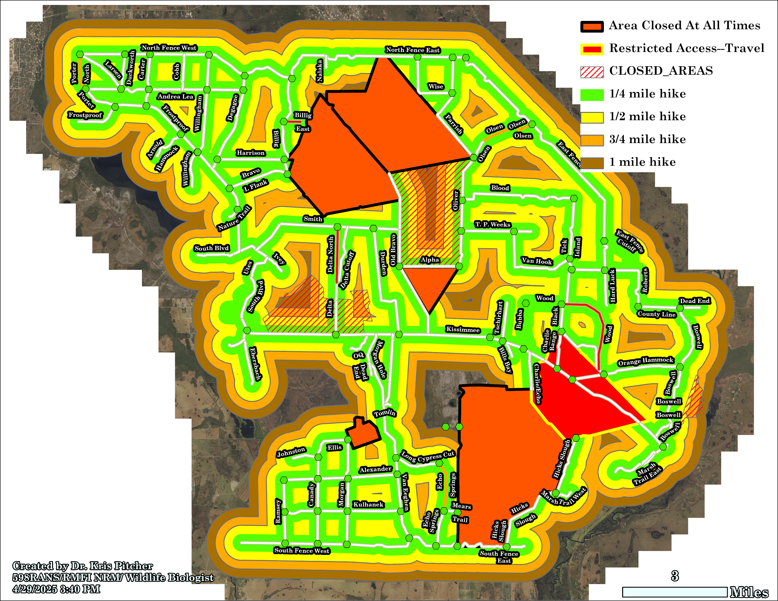
Foot Travel Coverage Map
The map below shows the areas that can be covered on foot from any of the established and listed roadways on the current PRA Map (above). Distances are color-coded, with BROWN being a 1-mile hike from an established road/trail. The only areas outside that maximum distance are the center of Arbuckle Marsh in Unit 13 and the eastern portion of Unit 11 backing onto South Tactical Range. All other areas across 75,000-acres can be accessed on foot with no more than a 1-mile hike. Please note, RESTRICTED and CLOSED AREAS are shown on this map, and while the colored distances may reach into these areas, they are CLOSED TO PUBLIC ACCESS by USAF administrative action; individuals caught in these areas without authorization will be suspended, whether on foot or in a vehicle.
Military Unit Map (Military Permits ONLY)